May 20, 2022 to may 28, 2022
mt. chacaltaya |
Thanks to support of the USA Study Abroad program, funded by the US State Department, four US students will travel to Bolivia in May, 2022 to work with eight Bolivian students in conducting field research the goal of which is to improve the understanding of how pollution travels from the cities of La Paz and El Alto toward the summit of Mt. Chacaltaya.
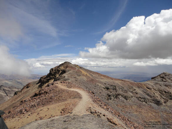
Mt. Chacaltaya, as seen on the left, was the location of the world's highest elevation ski resort until 2009 when the glacier upon which the skiing occurred fully melted. Long a site for cosmic ray research (discoveries made at Chacaltaya contributed to the award of the Nobel prize in both 1949 and 1950), concern over accelerated melting of Andean glaciers helped to motivate the establishment of a Global Atmosphere Watch (GAW) site at Mt. Chacaltaya in 2010. That site has been in near continuous operation since then and will serve as a focus of the student experiment described here. |
|
What Has Been Observed at the GAW station?
The GAW station is a World Meteorological Organization (WMO) program that supports networks of stations that monitor atmospheric compositions, rainfall and temperature data, and other information. In the earlier 2000s, there used to be a Ski Resort where the station stands today. Skiing took place on a glacier but ended in 2009 when the glacier fully melted. Currently, the station provides data on the average weekly black carbon concentrations and many other variables. Observations have revealed that that black carbon concentrations frequently increase in the late morning as seen in the figure on the right. |
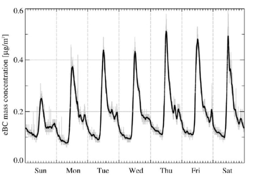
Mean weekly variation of Black Carbon observed at the Chacaltaya station during 2012-2014.
|
|
What Do We Think is Causing this?
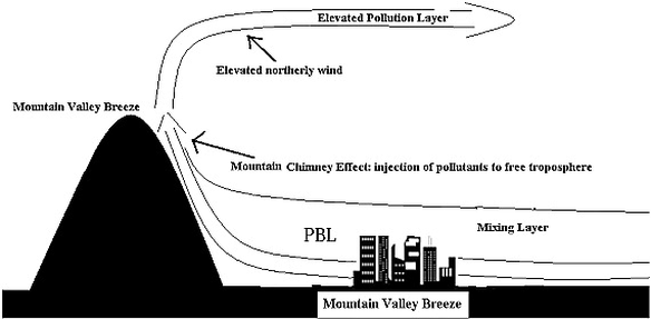
The city region of La Paz/El Alto is heavily populated and a source of considerable black carbon due to the incomplete burning of fossil fuels. We believe that the aerosols from the city are transported to higher elevations due to the Mountain Chimney Effect which is illustrated in the figure to the right. |
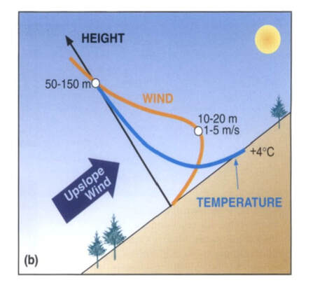
Upslope winds due to surface heating create the "Mountain Chimney Effect" and help to transport pollutants to higher elevations.
|
|
What do we Plan to do During the Campaign?
During this campaign, we will place instruments along a likely pollution pathway to measure the onset of the MCE. We will measure black carbon, winds and the temperature profile near the surface using mini-tethersondes. Here is an article that appeared in the Greenbelt News Review describing the experience of the 4 Eleanor Roosevelt students who particpated. |
|
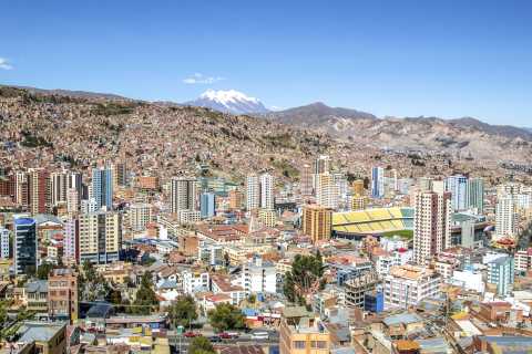
The city of La Paz with the Ilimani mountain in the background.
Data Access Policy - Data acquired prior to and during the field campaign scheduled for May 20-28, 2022 will be available solely to the students and mentors involved in the campaign for 12 months after the end of the campaign. After that time all data become freely available via a data request form that will be available below.
